|
||
|
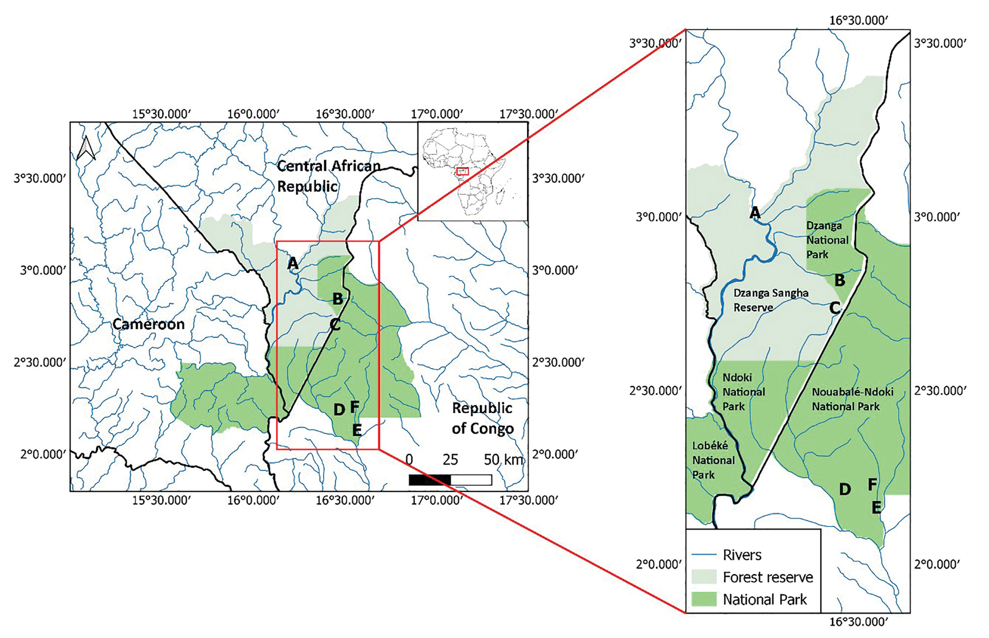
Map showing the location of the Sangha Trinational within the African continent, and the position of the plot sites. Letters represent sites where the plots were located. Sites A, C, D, and E are mixed terre firme forest plots, and sites B and F are Gilbertiodendron dewevrei plots. Created using QGIS v.3.22. |